walk Malverns walking UK England hikeing
 Walk! around the
Malverns with Bob Greaves
Walk! around the
Malverns with Bob Greaves
ISBN
978-1904946-762 £12.99 148 pages full colour, 25K scale OS
Explorer mapping, perfect bound.


GPS navigation files available - see GPX Downloads
Important
Update:
Changed start
to Walk 24 download new page 106 for your book, plus slight change on Walk 25
due to 'ancient way' being closed.
Walk! around the Malverns isbn 978-1904946-762 £12.99
148 pages in full colour with
25K scale OS
Explorer mapping and gps waypoints.
See Updates for a
small correction on the GPS Waypoint Lists
Each walking route
itinerary includes:-
- walking route summary
- ratings for Effort, Time, Distance, Ascents/Descents,
Refreshments and Vertigo risk
- fully detailed walk description, including frequent timings to
aid navigation and check your progress
- GPS Waypoints at every key point on every route for pin-point
navigational accuracy
- full colour 1:25,000 scale OS Explorer map of the route
- short walk and stroll alternatives
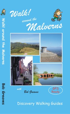
Walk! Around The Malverns with Bob Greaves
Experienced walking guide researcher and author Bob Greaves leads us on thirty
walks of discovery in his home area in Walk! Around The Malverns. Ranging from
gentle riverside strolls to a strenuous hike along the total length of the
Malvern Hills (including all its summits), there are walks for all abilities.
Roughly enclosed by the ancient towns of Worcester in the north of our area,
Hereford in the west and Gloucester in the south, the area covered included a
wide variety of landscapes; even those who are familiar with the area should
find a few pleasant surprises.
Some routes exploring villages and areas of historic interest; Bob shares his
extensive local knowledge to enhance your experience. The rivers play an
important part in shaping the area and several walks include sections passing
along their banks and to the settlements connected to them. And then there are,
of course, The Malverns themselves; ancient, prominent hills from which
magnificent views are to be had. As Bob says, "My aim throughout is to inspire
confidence." Each walk is fully described and includes regular timings, compass
directions and GPS data ensuring that you'll stay on track.
It's easy to find the start of each walk as postcodes and OS references will get
you to the spot and there are details of public transport options. Before you
set out you'll know the length of the route in both miles and kilometres, the
time it took the author to complete the walk, difficulty level and heights
climbed and descended. Most routes include a good local pub or cafe for on-route
or end of route refreshments, almost all of which have been tested by the
author. All the walks have been re-walked and researched within the last year so
you can be sure all the details are up to date.
Each detailed walk description is accompanied by licensed OS Explorer (1:25,000
scale) map sections overlaid with Bob's route plus the waypoints he recorded at
key decision points and places of interest. Colour photos capture key points
along each route bringing the route alive as you read the description. 'Walk!
Around The Malverns' will enrich your visit to this beautiful region and we
thoroughly recommend it as your 'companion' as you walk around The Malverns.
There are some easy routes. There are some challenging routes for
fit experts. With Bob’s excellent walk descriptions
you’ll know which routes are for you - and all of them are a
true adventure.

Walk! Around The Malverns
– Contents
The
Author & Acknowledgements
Introduction
The Area Covered, Where To Stay, History,
Geology, The Routes, Access by car, Access by public transport, GPS
anomalies
Map & Walking Information
Walk Locator Maps, Symbols Rating Guide, Ordnance
Survey Mapping, Using GPS around the Malverns, Walking Equipment
THE WALKS
1
Bredon Hill
from Westmancote
3/4 walker, 3 hours 52 mins, 9.1 miles/14.6km, ascents
& descents 260 metres, 3 refreshments (circular)
2 Overbury
3 walker, 3¼ hours, 7.7 miles/13.9km, ascents & descents 260 metres, 3
refreshments (circular)
3 Elmley Castle 3/4 walker,
3 hours, 7.2 miles/11.5km, ascents & descents 340 metres, 3 refreshments
(circular)
4
Woollas
Hall
2/3 walker, 2 hours 05 mins, 5.1 miles/8.5km, ascents & descents 370 metres,
0 refreshments (circular)
5 Eckington Bridge
3 walker, 3 hours 22 mins, 8.8 miles/14.1km, ascents & descents 120 metres,
4 refreshments (circular)
6 Pershore Bridge and Tiddesley Wood 1 walker , 2 hours 11
mins, 5.6 miles/9km, ascents & descents 50 metres, 5 refreshments (circular)
7 The Severn and the Avon
2/3 walker, 3 hours 52 mins, 10.8 miles/17.3km,
ascents & descents 120 metres, 5 refreshments (circular)
8 Odda’s
Chapel
1 walker, 2 hours 09 mins, 5.4 miles/8.6km, ascents & descents 67 metres, 4
refreshments (circular)
9 Upton upon Severn
1 walker, 1 hour 43 mins, 4.4 miles/7km, ascents & descents 30 metres, 5
refreshments (circular)
10 Worcester
and The Severn
2 walker, 3 hours 41 mins, 8.3 miles/13.3km, ascents
93 metres, descents 130 metres, 2 refreshments (linear)
11 Worcester
and its Canal
2 walker, 2 hours 41 mins, 7.7 miles/12.3km, ascents
123 metres, descents 86 metres, 2 refreshments (linear)
12 Hanley Castle & Hanley Swan 2 walker, 3 hours 14 mins, 8.2 miles/13.1km, ascents &
descents 111 metres, 3 refreshments (circular)
13
Madresfield Court 2 walker, 2 hours 39 mins, 7.0 miles/11.2km, ascents &
descents 100 metres, 0 refreshments (circular)
14 The Full
Monty
5 walker, 4 hours 11 mins, 9.8 miles/15.7km, ascents
877 metres, descents 787 metres, 4 refreshments (linear)
15 Between
Great Malvern & Colwall Stations 3 walker, 1 hour 52 mins, 4.3 miles/6.8km, ascents 250
metres, descents 200 metres, 4 refreshments (linear)
16 North
Hill from Link Common 4 walker, 1 hour 43 mins, 3.2 miles/5.2km, ascents &
descents 320 metres, 4 refreshments (circular)
17
Worcestershire Beacon
3/4 walker, I hour 32 mins, 3.5 miles/5.6km, ascents &
descents 250 metres, 4 refreshments (circular)
18 Holywell
& ‘The Kettle Sings’ 3 walker, 1 hour 25 mins, 3.5 miles/5.6km, ascents &
descents 220 metres, 4 refreshments (circular)
19
Herefordshire Beacon from Castlemorton Common 3 walker, 2 hours 26 mins, 5.6 miles/8.9km, ascents &
descents 300 metres, 4 refreshments (circular)
20
Castlemorton Tump
2 walker, 2 hours 04 mins, 5.3 miles/8.5km, ascents &
descents 110 metres, 2 refreshments (circular)
21 Eastnor
Park
2 walker, 1 hour 55 mins, 4.4 miles/7.1km, ascents 160
metres, descents 250 metres, 5 refreshments (linear)
22 Gullet
Quarry & Midsummer Hill 4 walker, 2 hours 33 mins, 6.2 miles/9.9km, ascents &
descents 250 metres, 3 refreshments (circular)
23 Ragged
Stone & Chase End Hill 3 walker, 1 hour 21 mins, 3.2 miles/5.1km, ascents &
descents 250 metres, 0 refreshments (circular)
24 Cradley
& West Malvern
4 walker, 3 hours 11 mins, 6.5 miles/10.4km, ascents &
descents 350 metres, 3 refreshments (circular)
Important
Update:
Changed start
to Walk 24 download new page 106 for your book.
25 Old
Storridge Common 2 walker, 2 hours 25 mins, 5.7 miles/9.1km, ascents &
descents 337 metres, 2 refreshments (circular)
26 Colwall
Church, Oyster Hill & Ledbury 3 walker, 3 hours 7 mins, 8.2 miles/13km, ascents &
descents 320 metres, 5 refreshments (circular)
27 The
Daffodil Way 4 walker, 3 hours 22 mins, 9.7 miles/15.5km, ascents &
descents 185 metres, 4 refreshments (circular)
28 Around
Haugh Wood 4 walker, 4 hours, 8.9 miles/14.2km, ascents &
descents 360 metres, 3 refreshments (circular)
29 Fownhope
& Capler Camp 4 walker, 3 hours 19 minutes, 8.3 miles/13.3km,
ascents & descents 383 metres, 3 refreshments (circular)
30 May
Hill
2/3 walker, 1 hour 51 minutes, 4.7 miles/7.5km, ascents & descents 279 metres, 4
refreshments (circular)
GPS Waypoints Lists
Appendices
A Public Transport
B Where To Stay
Place Names Index
Important
Update:
Changed start
to Walk 24 download new page 106 for your book.
GPS navigation files available - see GPX Downloads Custom Maps for Garmins
Home Page
Lake District North Lake District South Peak District South Dartmoor
Exmoor South Downs
Yorkshire Dales South Pennines Dorset Isle of Wight
Devon Brecon Beacons Titles Abroad