Coast to Coast C2C Wainwright
Garmin walk
walking hike hiking
 Coast to Coast - Adventure Package with David Brawn
£11.99 isbn 978-1782750208 available as digital download zip file from
Discovery Walking Guides
read, and print
our 'Buy and Use C2C Adventure Package' before
purchase
Walk! the Coast to Coast walking routes available on
 2014 see OSlike Custom Maps for Garmins
On a fortnight's adventure with my
mates Keith and Nigel from St Bees to Robin Hood's Bay (July 2012) I talked to
loads of C2Cers subtly asking what would make the route better. What everyone
wanted was accurate navigation along the route. There are loads of guide books
about the C2C so rather than adding another book I have produced what every
C2Cer wants - a system of accurate navigation for the whole route.
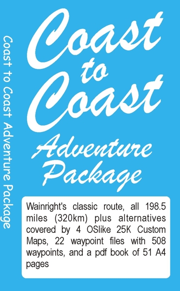
Coast to Coast - Adventure
Package by David Brawn, Discovery Walking Guides, isbn 978-1782750208
£11.99
Adventure Package – Resources
OSlike 25k scale digital Custom Maps. Alfred Wainright’s (AW) complete Coast to
Coast route (modern edition), along with popular alternatives, is covered by
four kmz Custom Maps which can be used in Google Earth, Garmin Basecamp and
loaded into Garmin mapping gps units using the Custom Maps facility.
AW’s Classic Route is shown on the maps as a dashed red line complete with
direction arrows. Alternatives including Helvellyn, Calf Crag, St Sunday Crag,
are shown as red or blue dashed line with direction arrows.
OSlike Custom Maps
consist of:-
c2cdays1to3.kmz: file size10Mb, map size 14,823 by 3,331 pixels, 60
tiles. St Bees to Grasmere. Walking route includes Calf Crag alternative ridge
descent to Grasmere.
c2cdays4to7.kmz: file size 20.2Mb, map size 21,459 by 6,130 pixels, 99
tiles. Grasmere to Keld. Walking routes include Helvellyn and St Sunday Crag
alternatives
along with the three Green, Red and Blue routes between Kirby Stephen and Keld.
c2cdays8to13.kmz: file size 14.4Mb, map size 29,089 by 3,047 pixels, 87
tiles. Keld to Blaky Ridge.
Walking routes include the High, Low and River routes between Keld and Reeth,
plus two alternative approaches to Danby Wiske.
c2cdays14to15.kmz: file size 6.7Mb, map size 11,523 by 4,609 pixels, 44
tiles. Blaky Ridge to Robin Hood’s Bay.
GPS Waypoint Files for AW’s Classic Route plus Alternatives
Each section of our Coast to Coast Adventure has its own file of gps waypoints
that provide us with pin-point navigational accuracy.
Waypoints are chosen to highlight ‘decision points’ on the walking route where
we need make a decision as to which route we take,
and also to provide general walking direction to the next waypoint along the
walking route. For all sections we have limited the number
of waypoints to less than 50 so that the waypoint file can be saved as a route,
using Garmin BaseCamp, which can be loaded into your gps.
‘c2c waypoints as .gpx files’ contains the following waypoint files in
gpx file format:-
0 St Bees Circular. Day 1 St Bees to Ennerdale Bridge. Day 2 Ennerdale Bridge to
Rosthwaite. Day 3 Rosthwaite to Grasmere Valley Route.
Day 3 Rosthwaite to Grasmere Calf Crag ridge route. Day 4 Grasmere to Patterdale
low valley route. Day 4 Grasmere to Patterdale Helvellyn route.
Day 4 Grasmere to Patterdale via St Sunday Crag. Day 5 Patterdale to Shap. Day 6
Shap to Kirkby Stephen.
Day 7 Blue route to Keld. Day 7 Green route to Keld. Day 7 Red route to Keld.
Day 8 Keld Reeth High route. Day 8 Keld Reeth Low route. Day 8 Keld Reeth River
route.
Day 9 Reeth Richmond. Day 10 Richmond to Danby Wiske. Day 11 Danby Wiske to Clay
Bank.
Day 12 Clay Bank to Blaky Ridge. Day 13 Blaky Ridge to Grosmont. Day 14 Grosmont
to Robin Hood’s Bay.
Coast to Coast Adventure Package – The Book
Simply with our Custom Maps and Waypoint files on your Garmin you can
accurately navigate the Coast to Coast and its popular route options.
Most people would also like to see their chosen route on a larger screen than a
Garmin gps.
They may also like to read the navigation details as a walking route rather than
one waypoint at a time.
So we have designed ‘The Book’ comprising the Custom Map(s) complete with
Waypoints along with navigation details for each stage
of the Coast to Coast route as A4 pages in pdf format so you can view these on
screen or print off the stages you want to read and use on your adventure.
‘The Book’ totals 51 A4 pages in 15 sections comprising:-
0 St Bees Circular – knock off the first section of AW’s route on the
afternoon you arrive in St Bees.
Day 1 St Bees to Ennerdale Bridge
Day 2 Ennerdale Bridge to Rosthwaite
Day 3 Rosthwaite to Grasmere over Lining Crag and Greenup Edge, plus Calf
Crag ridge descent to Grasmere
Day 4 Grasmere to Patterdale with Helvellyn and St Sunday Crag options
Day 5 Patterdale to Shap
Day 6 Shap to Kirkby Stephen
Day 7 Kirkby Stephen – Nine Standards Rigg - Keld with Red, Blue and
Green Routes
Day 8 Keld to Reeth High route, Low route and River route
Day 9 Reeth to Richmond
Day 10 Richmond to Danby Wiske
Day 11 Danby Wiske to Clay Bank
Day 12 Clay Bank to Blaky Ridge
Day 13 Blaky Ridge to Grosmont
Day 14 Grosmont to Robin Hood’s Bay
Coast to Coast Adventure
Package
isbn
978-1-78275-020-8
'OSlike' Custom Maps,
gpx waypoints, pdf ebook of 51 A4 pages; as zip file £11.99
read, and print our 'Buy and Use C2C Adventure Package'
before purchase
Purchase with PayPal.
After your PayPal purchase and payment is completed you will receive an email
with your download link, also check your Spam folder for the email.
Please click on the download link in your email to download your Coast to Coast
Adventure Package soon after purchase as the encrypted link is time
limited.
Home Page Titles Axarquia Lanzarote La
Gomera
La Palma
Custom Maps for Garmins
Walk! Abroad
Walk! at Home-UK DWG sitemap